Aerial Solutions
Technological expertise serving your projects.
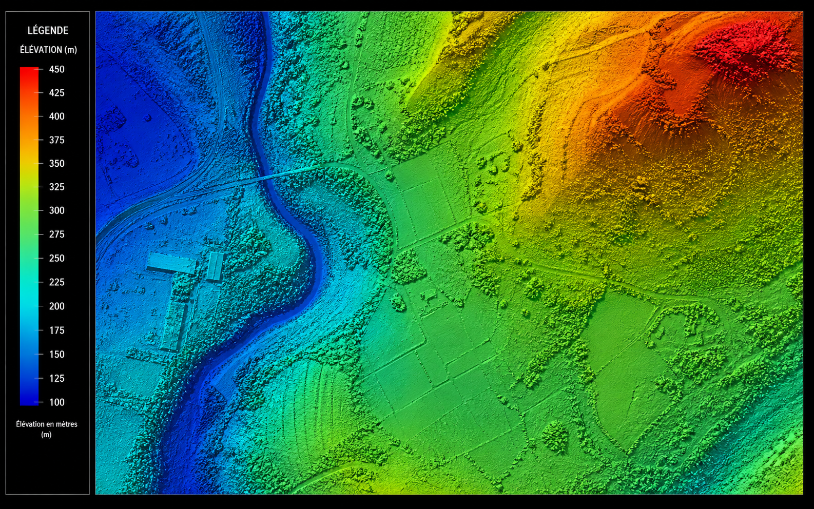
Modeling & Precision
High-resolution 3D scanning for complex infrastructure.

Multispectral Analysis
Optimization of agricultural yields and vegetation health monitoring (NDVI).

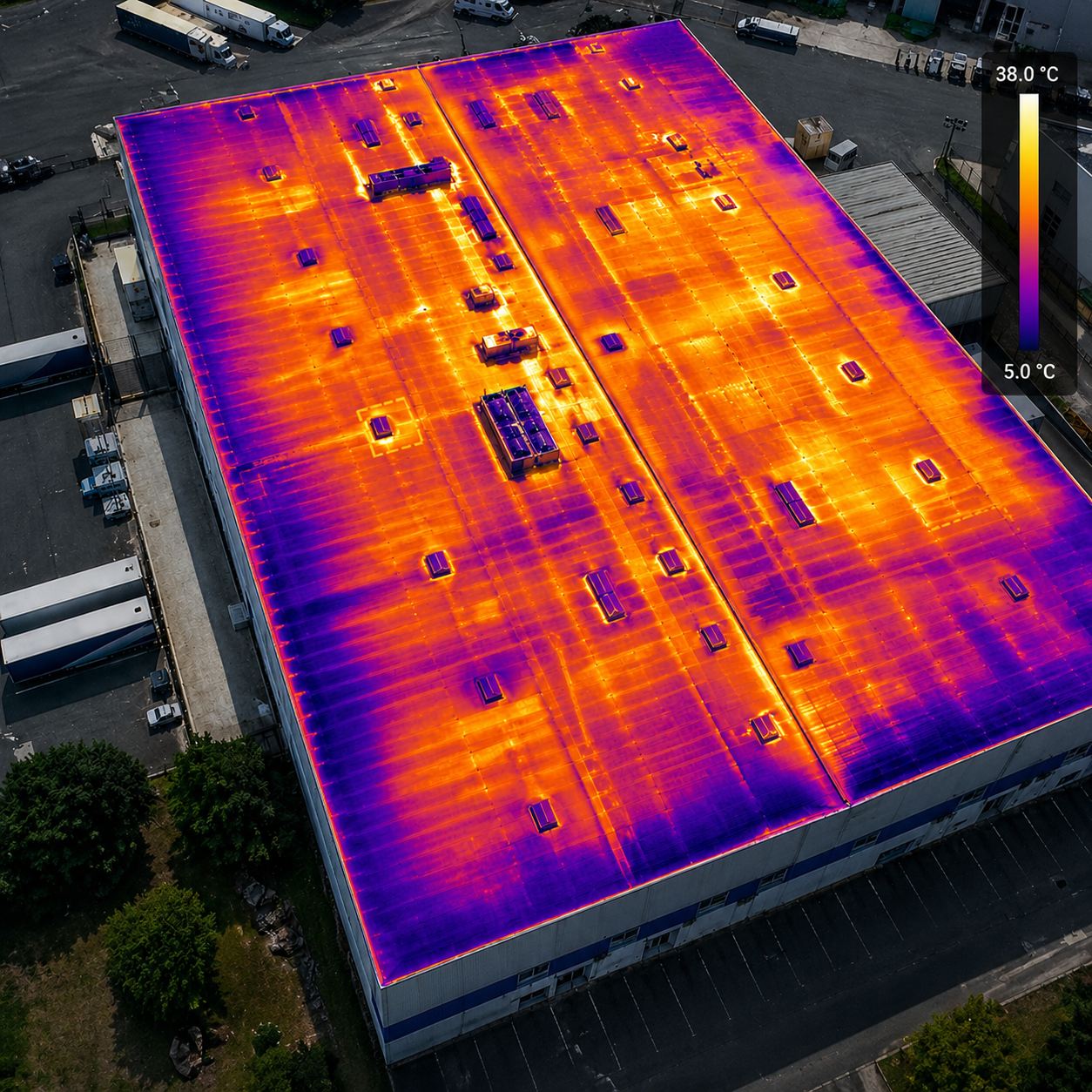
Technical Inspection
Predictive maintenance and structural analysis using drones.


